|
|
|
ELECTRICAL RESISTANCE TOMOGRAPHY
|
PROVIDING PROFESSIONAL GEOPHYSICAL SURVEYS TO MEET A WIDE RANGE OF CLIENT NEEDS FORREST ENVIRONMENTAL SERVICES, Inc. (FES, Inc.) specializes in the conduct of geophysical surveys to provide clients with critical subsurface data collected through non-invasive, non-destructive methods. FES Inc. has conducted hundreds of successful geophysical surveys providing clients with the data needed to make sound decisions. The application of geophysical methods is a cost effective means of obtaining substantial subsurface data along continuous lines and areas that cannot be obtained through traditional methods of borings and trenching. CLIENTS Our clients include the following:
APPLICATIONS Geophysical surveys can provide critical information on subsurface conditions and are frequently conducted for hydrogeological and geological investigation, environmental assessment, mineral exploration, geotechnical investigations, and anthropological assessments. Some common applications are outlined below. Specific FES survey examples and project summaries are provided within each application grouping (click to see examples and project summaries): Anthropology
Environmental
Geotechnincal
Mining
Water Resources
METHODS FES provides the following geophysical survey methods (click to see more information on each method):
The use of such methods in a site investigation, where subsurface conditions are unknown or questionable, can lead to significant short term and long term cost savings. FES can bid surveys at costs well below other geophysical specialty firms. Our strong hydrogeological and environmental consulting background and experience enables us to select appropriate survey applications for a given set of site conditions. Our ultimate goal is to provide our clients with a high quality and timely product while maintaining cost effectiveness. To receive a bid or for more information concerning geophysical methods or if you have questions regarding your specific needs and site concerns, please contact us.
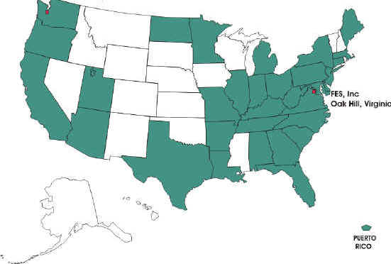
We have conducted geophysical surveys in many states across the U.S. We have also conducted surveys in Canada and Mexico.
|